

Every waterfall on this website includes a box of quick facts. These help to identify specific characteristics about each waterfall and its surroundings.
Some of the terms used to describe each waterfall are open to debate. Big vs small, easy hike vs moderate hike, 1-star vs 3-star, step falls vs block falls, etc. Take everything with a grain of salt!


This website divides Ontario into 8 different waterfall regions. These are the same regions that are used in the 'Waterfalls of Ontario' book. Region boundaries developed over time and aren't perfect, but they help to find waterfalls in your general area.
Each region has a 'Regional Waterfall Inventory', which can be reached using the 'Find' option on the top menu bar. Since the number of waterfalls in some regions is getting very large, 'subregions' have been added in some inventories. Learn more about Waterfall Regions...
Whether it be a great river or or a tiny unnamed stream, every waterfall is on a watercourse of some sort. Sometimes, a placeholder name is provided, such as 'Tributary of Sandy River.' Some watercourses have an official name and a local name. If you find an error, please let me know.
Waterfalls are major points of interest on a watercourse. But watch for other interesting scenic and historic river features as you travel to and from a each waterfall.


A watershed is the area of land that drains to a watercourse. Any point along on a river, such as a waterfall, can have its own watershed. Bigger watersheds usually have bigger rivers and flows, but not always.
For this website, each watershed is assigned a size value. Watersheds with a score of 0 or 1 usually have creeks that a person can hop or wade across. Waterheds with score 5 or 6 have rivers that would probably need a motorboat to cross. Learn more about watersheds...
The %Lakes value tells us what percentage of the watershed area is covered by lakes and wetlands. A bigger value usually means that flow is more reliable, but not always. Learn more...
With only a few exceptions, waterfalls located on private property are not included in this website. If a waterfall is surrounded by private property, only a landowner can decide who enters their property.
An attempt was made to identify the ownership status of the land around each waterfall. No guarantees are provided, and ownership status can change. Be sure to see the Website Disclaimer... This website does not give you permission to trespass.
Some waterfalls that are on private property can be viewed from the roadside. These are marked as "Roadside Only".


Waterfalls come in all shapes and sizes. Bigger waterfalls can be more impressive, but little waterfalls can be rewarding too!
New waterfall fans are often obsessed by height. This project doesn't focus on height, because people then assume that a 10 m high waterfall is 'twice as good' as a 5 m high falls. This is only true sometimes.
The size values provided here are subjective. Large waterfalls can be tall, but they can also be lower but powerful. Some 'large' waterfalls include High Falls on Pigeon River, Inglis Falls, and Magpie Falls.
Small waterfalls are often not much taller than a person. This includes pretty places like Little Davis Falls,Lovers Rapids, and Morrow Lake Falls.
The 'Watefalls of Ontario' project uses a waterfall classification system. that was published in the 'Waterfalls of Ontario' Book.
This system used here is largely based on geology. It's important to understand that the types blend into each other, and that some waterfalls have elements of more than one type. You can learn more about the various waterfall types in the Waterfallogy section.
Many waterfalls have a modification like a dam, bridge or culvert. Some people think that these structures ruin the appearance of a waterfall. Others understand that they actually show the importance of waterfalls to our society.


Waterfalls marked as "Easy" can be visited by almost anyone. They typically have short, well-maintained trails and few hills.
Waterfalls marked as "Moderate" usually have trails that most people can manage. But there might be some hills, muddy sections, or rocks to climb over.
Waterfalls marked as 'Difficult' may have trails that are long, steep, unmarked, or absent altogether! If you aren't an experienced hiker, these should be avoided. Sometimes its easy to see a falls from a distance, but difficlt to get close.
Note: The coloured stars and map dots relate to the "Access" rating, but also characaterize the drive to waterfall. Green stars and map dots can easily be reached by most people, even if the trail itself might be moderate.
Yellow stars and map dots signify a tougher trip that isn't for everyone; trails will be moderate to difficult. The reason for yellow codes is usually identified in the description. Learn more about waterfall ratings...
The trail surface at waterfalls can also give an idea of how easy it is to visit. Most waterfalls with access marked as "Easy" have paved trails, gravel trails, or flat dirt trails.
Most waterfalls with access marked as "Moderate" have gravel, dirt or bedrock trails. There may be some 'uneven ground' or hills that aren't hard for most people to navigate. But these may be obstacles for people with mobility challenges.
Some waterfalls have no trail whatsover. These are usually marked with yellow stars and map dots; they are no walk in the park! Still other waterfalls have only water-based access; ie. there is no trail from a parking spot
This is an estimate of the duration of time to reach the falls from the parking area. This is only an estimate; everyone hikes at a different pace.


Sometimes we can park right next to a waterfall, but sometimes the two features are far apart. This website now identifies the location of the waterfall AND a suggested parking location.
By clicking on the "Driving" button on any waterfall page, you will get Google Directions to a parking location. This is sometimes a dedicated parking lot but may also be a roadside location.
WARNING! Every person is responsible for determining whether any suggested parking location is both safe and legal (see the website Disclaimer. Conditions can change. The 'Waterfalls of Ontario' project recommends against parking along roads with high traffic speeds.
Waterfall coordinates were determined using a mix of GPS and aerial photography. If using a mobile phone with location activated, you can click the "Hiking" button on any waterfall page. This will show a red dot for the waterfall and a blue dot for your current location.


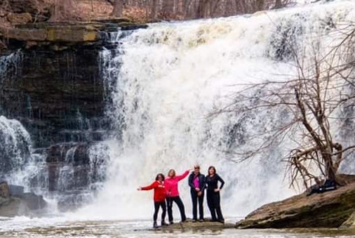
Join our Facebook community to share tips, photos and updates. Operating since 2011, this well-moderated, respectful, and informative group is the hub of Ontario's waterfalling community. (Photo by Martin Van Opstal)
