
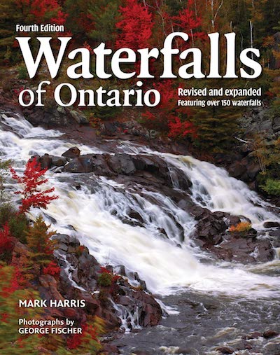
Look for the book in stores or buy it online!
Show that you belong with your group badge! Just $8.99, including shipping.
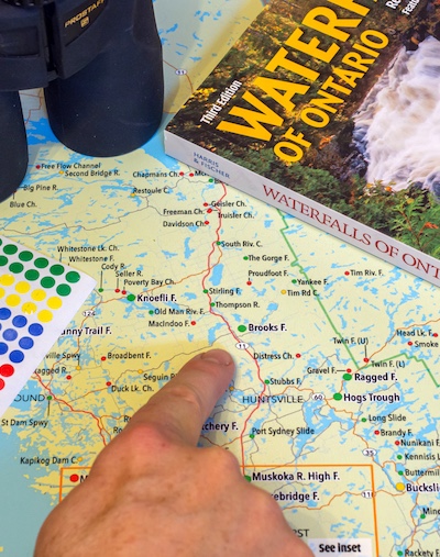
Big waterfall fan? Why not get a 36" wall map and track your progress?

Please join our Facebook community. Well-moderated, it's all waterfalls, all the time! *Don't limit yourself to the information on this page; ask our 35,000 members for ideas.

Follow @waterfallsofontario on Instagram. Slowly getting caught up, but lots of great photos and interaction.
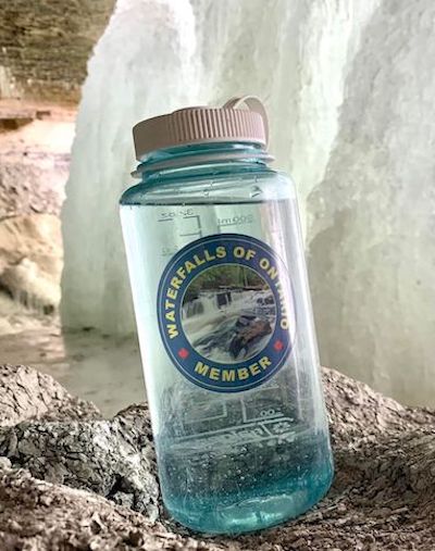
Show that you belong with your group sticker! Just $5.99, including shipping.
The Ongoing history of waterfalling in Ontario
The following account is a biased, incomplete history of waterfalling and waterfall appreciation in Ontario. The original intent was to document the history of the 'Waterfalls of Ontario project.' It eventually expanded somewhat so that it would be of more interest to the broader waterfalling community.- Early History
- Early Twentieth Century
- Later Twentieth Century
- The 1990s
- Predecessor to 'Waterfalls of Ontario'
- The Waterfalls of Ontario Book
- The Hamilton Explosion
- Waterfalls get social, More books arrive
- The Covid Pandemic
- 2021 and Beyond
1. Early History
The history of waterfalling and waterfall appreciation in Ontario starts with Niagara. Indigenous people are believed to have lived in the Niagara area for about 9,000 years. They may have known the falls as “Onguiaahra”. This link provides an early history of Indigenous people in NiagaraThe great explorer Samuel de Champlain never saw the falls, but wrote about being told about it by Indigenous peoples. It was ‘discovered’ by the French explorer named Father Louis Hennepin in 1678. He described the site as “horrible”; something like this didn’t sit well with Europeans, who saw the natural world as something to be conquered.
 Father Louis Hennepin at Niagara. Public domain.
As North America was settled, the falls would become a popular destination for visitors. It has been reported that Napoleon Bonaparte’s brother was the first to honeymoon there in 1804. By the middle of the 1850s, shops and museums had been set up to cash in on visitors’ interest in the falls.
It was not long after settlement that Ontario’s waterfalls became known as a source of power. Either for helping to push logs downstream, or to power early saw mills and grist mills, and later, textile mills. Towns and cities grew up around waterfalls and used them to power their mills. But while places like Bracebridge, Almonte or Fenelon Falls now celebrate their waterfalls as scenic attractions, it was all business back then. People didn’t (and couldn’t) really travel great distances just to visit a waterfall for the afternoon.
 Logs moving downstream at Aguasabon Falls, near Terrace Bay. Public Domain
2. Early Twentieth Century
By the early 20th century, starting again at Niagara, water from the falls was used to generate hydroelectricity. The first large generating station on the Ontario side started in 1902, but was soon dwarfed by the Sir Adam Beck plant, built in 1922. If you like engineering, water, history and old buildigs, the history of power generation at Niagara Falls is really quite cool. Try this link or this link.Soon after, smaller (yet still powerful) generating stations were constructed at dozens of sites across Ontario. Many still exist, some of which are actually quite grand 100-year old brick buildings. The short document entitled Celebrating the history of water power in Canada gives a good overview of some these cool industrial buildings. Hydroelectric power is generally believed to be clean, but doesn't always sit well with waterfallers. Many falls were obliterated completely, or, left high and dry as the water was diverted through the penstocks to make power. These sites can still be fun to visit (some are completely fenced off), and overflow through the spillways still occurs during wet periods.
 Hydroelectric plant at Elliot Chute. The falls once rumbled over the smooth bare bedrock in front right. CC by Ontario Power Generation.
 https://www.flickr.com/photos/ontariopowergeneration/ 413785126/in/album-72157594575440068/
In what may be the first comprehensive survey of waterfalls (or more correctly, areas where water falls) in Canada, the federal government produced a book in 1911 called Water Powers of Canada. This was intended to show areas that could be used for hydroelectric generation. The book was remarkably detailed, listing a tonne of waterfalls (some of which we still haven’t listed on this site). It also lists a number of smaller spots where mills had already been constructed. It includes historic photos of places like Aubrey Falls or the falls along the Montreal River.
 One of the tables of potential hydro power locations, from 'Water Powers of Canada, 1911'.
Geologists took a keen interest in Niagara Falls right from early years. The famous American geologist, GK Gilbert wrote "Niagara Falls and their History" in 1895, and then "Rate of Recession of Niagara Falls" in 1907. Neither of these works were of any interest to the general public. But Gilbert's work was really important as it identified and studied how the falls were receding upstream. We know that this occurs at all waterfalls, though at varying rates.
It wasn't just geologists who would notice the power and beauty of our falls. The great Canadian artist group "The Group of Seven", along with their contemporary, Tom Thompson (who was not a member), spent years travelling the back woods of Canada. Their subjects were often the great unspoiled vastness of our country. But they also captured more intimate scenes, and like anyone else, were often drawn to waterfalls.
You can search for paintings of waterfalls and rapids by Tom Thomson, J.E.H. MacDonald and others. Copyright on the paintings has expired because the artists died more than 70 years ago (as per Canada Copyright Act). This puts their works in the public domain. Property rights, exerted by the painting owner may still prevent the posting of photos of the paintings.
3. Later in the Twentieth Century
After World War 2, with the widespread use of automobiles and better roads, Ontarians started to visit the hinterland. Some waterfalls along well-travelled provincial highways became scenic spots for road-side rest stops.
Family picnic at Aubrey Falls, 1952. Contains information licensed under the Open Government Licence – Ontario.
In the early 1970s, the Ontario Department of Mines published a small series of books entitled “Geology and Scenery”. Though they were aimed at the amateur geologist, they included photos and descriptions of a number of waterfalls. "Geology and Scenery. North Shore of Lake Superior", for example, gave a good account of many of the waterfalls that we visit around the Thunder Bay area. These books had a profound effect on me as first started to write about exploring waterfalls.
 One of the series entitled 'Geology and Scenery', published by Ontario Department of Mines.
In 1981, another influential geology-based book about Niagara was published, Colossal Cataract. Ten years later, when I started my BSc in Physical Geography at Brock University, this book touched on all the geosciences that I was studying.
Shortly after, in 1992, Pierre Berton wrote Niagara. A History of the Falls". As one of Canada's foremost historians, this is a gold mine of information about the early and not-so-early history of the Niagara Area.
4. The 1990s
Have you noticed a pattern so far? To date, much of the history to date has focused on Niagara Falls. To my knowledge, there were no publications dedicated specifically to the waterfalls across Ontario.As mentioned, in the early 1990s I was studying Physical Geography at Brock University. I studied geomorphology, climatology, soil science, sedimentology, ecology. Each week until winter, our professors would take us to a natural spot in the Niagara Peninsula for a field trip to study what we were learning in class.
Geomorphology classes with Dr. Keith Tinkler and Dr. John Menzies were the most fun. On a number of occasions we visited the rock-bed channels of streams that crossed the Niagara Escarpment. At each one, there was a waterfall. Even as a 21-yr old I thought, "These are cool places!"
 Not everyone has a classroom that looks like this!
A student that was just a few years ahead of me wrote a BSc thesis entitled "Characteristics of bedrock waterfalls along the Niagara Escarpment in the Niagara Peninsula, Ontario" (Debbie Stenson, 1990). Was this the first document in Ontario that specific focused on multiple waterfalls?
In 1998, the town of Bracebridge held it's first "Festival of the Falls". This included bus trips and self-guided drives to the best of the town's 22 waterfalls. There were some rumours that they had more waterfalls in the municipality than anyone else. We'd soon figure out that this was not the case, of course! However, compared to the actual title holder, my guess is that the total flow of water over all the falls in Bracebridge would put it in first place. The festival went on for at least five years, but is no longer in place, and there is surprisingly little online legacy left behind.
5. The Predecessor of Waterfalls of Ontario.com
In 1998-1999, I was finishing gradudate school at Wilfrid Laurier University. The world wide web was brand new. I took a couple of introductory classes in HTML but had no idea what to do with this. Around the same time, I inherited my grandfather's old SLR camera.During my "Gap month" (no trip to Europe for me!), I travelled around Ontario. I visited a number of well-known touristy destinations, including many waterfalls. With the SLR camera, I learned to slow the exposure to get the infamous "milky" long-exposure look for waterfalls. Very few people actually had the tools to do this back then, so I thought it was a big deal.
One day, when browsing the web, I found Scott Ensminger's 'Waterfalls of Western New York' web site. I found out that he had similar interests to me, and that he had been cataloguing the waterfalls in his part of New York state since the early 1990s. He had also branched into the Niagara Peninsula (crossing the border was a lot easier back then!). He had published a short book called "A Waterfall Guide to Letchworth State Park", and had just recently created a web site. Seeing his web site was the final push that I needed to try to create my own.
In late 1999, 'Waterfalls of Southern Ontario' went online.
The site was initially hosted at 'www.multiboard.com/ ~mharris/waterfall.htm' Multiboard.com, a London upstart, would soon become Start Communications (Start.ca), which now serves all of southern Ontario. All that remains of 'Waterfalls of Southern Ontario' are a few dead links on other waterfall web sites... like this one or this one.
My web site was very basic, but started the trend of providing accurate directions for people to visit waterfalls. I started with the falls in Niagara and Muskoka, both of which I knew fairly well. Then I added Hamilton and Central Ontario, eventually reaching Owen Sound.
In 2000, Jerry Lawton and his son Mikal wrote 'Waterfalls The Niagara Escarpment', which was published by Boston Mills Press. It was 6" by 9", 144 pages long, and black and white. Full colour printing was still expensive at the time. As far as I know, this was the first widely-published guide to waterfalls in Ontario. It was a great resource, and helped me to find new places along the Niagara Escarpment. The book is out of print, but is worth seeking out.

Finding waterfalls in the old days wasn't easy! There was no social media, no google maps, no online aerial photos, no other web sites, and no books other than the Lawton's book. My biggest resource was the 1:50,000 scale topographic maps that any good geography student horded. I was thrilled that you could purchase the entire set on CD-ROM... having all those maps in one place would have cost a fortune! "You younger waterfallers have no idea how easy you have it these days!"
 For years, this was how you found waterfalls. Many of the locations on this web site (and now featured on others like it) were 'discovered' by clues on topographic maps like this one.
As I built my web site, I was surprised to find that there were many other web sites just like it! Around 2000, I co-initiated the Waterfalls Web Ring along with Roger Hopkins of New York State. You can still see the join page . This tied together a number of similar sites across the world. Many from the United States, but also some from Europe (like this one... still kicking 20 years later!) and Australia.
Web rings were a cool concept that doesn't appear much any more. So cool at the time, in fact, that our web ring was covered in an Article by the New York Times. Naturally, Ontario wasn't featured in an American publication, but it was an early success story.
6. The Waterfalls of Ontario Book
In 2002, out of the blue, I was approached by an editor with Firefly Books. They were working with accomplished photographer, George Fischer, who was accumulating photographs of waterfalls from across Ontario. Firefly found my web site and asked if I was interested in providing captions for George's waterfalls. I got talking to them and proposed something a little more... could we combine some of my geography/geology/tourism writing with George's photos? Left meets right? Arts AND Science? They bought the idea!Through 2002 and early 2003, I set out traveling further across southern Ontario. I finally reached the Ottawa Valley and the Algoma Region, travelling as far as Wawa. George and I never travelled together. We really had no idea what the other person was doing! By the time that the book reached stores in fall of 2003, we knew that it had worked out after all!

The 2003 book featured George's beautiful full-page photographs in full colour. I contributed write-ups and directions for each waterfall, as well as maps and an introduction. The book also featured what is believed to the first province-wide inventory of waterfalls. This included many sites not shown nor named on any other maps. This work (and future updates) has since informed other waterfall resources.

In the winter of 2004, I was interviewed by Mary Ito on TVO Television. This was to help to promote the book. Over the next 5 years, the book would slowly but steadily sell out of all 10,000 copies.

By summer of 2004, I was a new father. This left virtually no time for waterfalls. The book was selling and the small but steady royalty was a nice bonus. By summer of 2006, I was a father again, and had even less free time on my hands.
In 2006, George Fischer asked me to help him with a second book, entitled 'Ontario's Historic Mills'. This seemed like a natural companion to our first book, as it dealt (mostly) with neat old buildings developed beside rushing waters. Working with Boston Mills Press, our book was published in 2007. Hitting more of a niche market, it didn't fare quite as well. However, if you stay in one of Ontario's old mills-turned-quaint-inns, be sure to watch for copies... I've been told on numerous occasions that these are on display, sometimes in guest rooms.
After the mills book was written, I was exhausted. Trying to raise a young family, working full time, and writing a book about a topic that I didn't know that much about, was just too much. So for the next couple of years, I made only a few minor updates to my web site. Around this time, for several years, I held the URL waterfallsofontario.ca . But my waterfalling activity was very limited.

7. The Hamilton Explosion
Around the same time that I was working on the 'Waterfalls of Ontario' book, something was brewing in Hamilton. During Scott Ensminger's earlier surveys of the Niagara Peninsula in the 1990s, he had reached as far west as Hamilton and together with the Hamilton Region Conservation Authority had catalogued some of the more available waterfalls in the area.In the early 2000s, Joseph Hollick, Stephen Head, Robert Nixon and a few others were doing their own survey of the waterfalls in Hamilton. The city is unique in that it is ringed by the Niagara Escarpment on one side, and by Lake Ontario on the other. As the natural outlet for regional drainage, rivers and streams converged on this end of the lake. These ingredients resulted in a lot of waterfalls being found here.
In 2002, Joe Hollick released the first of a series of posters to feature the waterfalls of Hamilton. Joe visited trade shows and fairs to sell his posters. Sales were brisk at times, though Joe spent a lot of time traveling to stores to deliver stock. Remember, there was no such thing as e-commerce at that time... you had to find Joe to find his poster! A few years later, Joe released other posters, with each one featuring a different season.
In 2005, building on the work of Hollick, Head, Nixon and a few other dedicated waterfallers, the Hamilton Conservation Authority released a report entitled 'Waterfalls and Cascades of Hamilton'. This was spearheaded by Joan Bell and Nadeem Paracha of the HRCA, though many others also contributed. They pushed the tourism potential of the falls to the City of Hamilton. You can see their early plans and a copy of the 2005 report in this staff note, in which they identify that they had catalogued 65 waterfalls.
Legend has it that Chris Ecklund, a local philanthropist and community leader, saw one of the posters at a silent auction around 2008. He was intrigued, and soon spearheaded the "City of Waterfalls" initiative. This was a new "brand" for Hamilton, something that was hoped would update the city's image. The web site City of Waterfalls.ca is a valuable reference of waterfallers in south-central Ontario.

Photo courtesy Chris Ecklund.

Photo courtesy Chris Ecklund.
Over the next few years, the brand caught on, in a big way! A city bus was specially 'wrapped' in waterfall decals, and special night-time illuminations took place at some of the bigger waterfalls. Lighting up the falls with dozens of colourful spotlights drew large crowds. Chris Ecklund was behind the publication of several books. Chief among these was Hamilton City of Waterfalls written in 2008 by Ecklund, Hollick and Rose Keefe. A year later, "The Golden Age of Waterfalling (1889-1905) was published." Both are out of print, but can be found in used bookstores and online. Any fan of Hamilton's waterfalls should seek these out.

Photo courtesy Chris Ecklund.

The "City of Waterfalls" initiative did a lot for Hamilton and its image. The popularity of the falls increased dramatically. As social media expanded further and the large tourism blogs from Toronto caught on, tourism increased VERY dramatically. Unfortunately, with all the successes, there also came a few problems.
Waterfall Challenges Places like Websters Falls, in particular, were being swamped with far more visitors than the infrastructure could handle. Nearby residents had to put up with traffic jams, people parking on their lawns, and in well-publicized events, unwelcome visitors using neighbour's backyards for picnics. Things got so bad that stakeholders demanded change. See this article, and this one for more information.
As Hamilton's waterfalls became even more popular, the difficulties grew. People not accustomed to waterfalling or hiking were getting stuck at the bottom of gorges and falling of steep cliffs. Rope rescues by Hamilton EMS were becoming a weekly occurrence. A death occurred at Tiffany Falls (due to a fallen tree, not irresponsible behaviour). In 2016, someone went hiking at Albion Falls at night in icy conditions. They fell, and sued the city due to their injuries. Shortly after, access to the base of Albion Falls was closed to the public. Access to the base of several other waterfalls (Websters Falls and Waterdown Falls) was later closed to the public.
In a way, Hamilton's waterfalls had become a victim of their own success. They had been promoted by various groups, and rightfully so. But did this bring just a bit too much notoriety? Or were these places just caught unprepared for the attention that they had deserved all along? Some might see this new popularity having led to the loss of access that we see at favourites like Albion Falls or Websters Falls. I'm not so sure. Given today's society, I believe that the closure of risky locations in highly-trafficked locations was going to happen eventually, with or without promotion.
Do you have the book?

8. Waterfalls get Social and More books get published.
Facebook went live on September 26, 2006. By 2008 it was the most popular social media platform in the world. Most of us in Gen X used it as a way to reconnect with long-lost high school friends. At the time, few saw it as anything else.In 2008, a Facebook group was started called 'Hamilton, Waterfall Capital of the World. In 2009, Peter Evelyn started a Facebook group called 'Waterfalls of Ontario, Canada.' These were new ways for people to share photos and discussion about waterfalls. Up until this point, almost all interaction was mostly one way... People like me, for example, would maintain a web site and others would get information from it. There were news groups and comment boxes, but information was really centralized. The use of social media helped to make the flow information move in more directions.
Another group of note is 'Waterfalls of the Niagara Escarpment', started in 2014 by photographer and explorer, Rob Wazny. Rob got his waterfalling start in Hamilton, but soon realized that there had to be way more uncatalogued waterfalls along the Niagara Escarpment. He also met his future wife, LA, while exploring waterfalls. Who said that waterfalls can't be a meeting place?
In 2010, Firefly Books told me that they were almost out of books and that they wanted to reprint more. Were there any corrections to be made? I said "How about we expand it?" It worked! George and I made a modest addition by adding the Northeast Ontario chapter. George happened to hit the north woods at the peak of fall colours, and was able to add spectacular shots of some of the big ones around Sudbury and North Bay.
Recognizing the popularity of waterfalls in the Hamilton area, we decided to carve the Hamilton waterfalls out of the "Golden Horseshoe" chapter. This created a chapter dedicated solely to waterfalls. I was able to use a few of my own photos to boost this chapter. In 2011, the Second edition of our book was published.

I was interviewed by Daiene Vernile of CTV News. She would later go on to become the Liberal MPP for Kitchener Centre. A couple of years later, Harold Stiver published 'Ontario Watefalls', which was offered in print and e-reader versions. You can see Harold's Ontario waterfalls web site.

Mark is interviewed by Daiene Vernile on Province Wide, CTV News. Note that he is wearing the same shirt that he wore with Mary Ito, 8 years earlier... selling books does not pay enough for a fancy wardrobe!
As a way of promoting the new book, I started the Facebook group 'Waterfalls of Ontario' on August 20, 2011. Although there was another similar group already in existance, and though I was a member of that group, I needed something that would specifically support and promote the book. As of 2021, both groups are still going strong, and many people are members of both. My hope was that my new Facebook group would be a way for readers to interact with one another. It worked!
The group grew slowly but steadily over the years. It attracted some real waterfall fans... one guy, Kit McCann, had been to over 500 waterfalls, and had the photos to prove it! In an archive.org copy of my web site in Sept 2014, it shows where I happily reported that our group had over 100 members! (In contrast, by 2012, the Hamilton group had 12,000 members). By May, 2017 we had over 3000 members. By August 3 2019, we had over 5000 members. This was about to change in 2020, but we will leave this story to the next chapter...

In 2017, I was again contacted by Firefly Books. Our second book was almost sold out. A new edition was sought and the publisher specifically wanted to "finish the book" by including a chapter on Northwest Ontario. A placeholder for this region had been added to the second edition, but it was only 4 pages long, including a map.
George was working on other projects at the time, and so I agreed to complete the third edition on my own. An epic journey to Thunder Bay ensued in spring 2017, and I finally got to visit some of the spectacular waterfalls found not far off Hwy 17. The "Thunder Run" as it is called, is a rite of passage for any Ontario waterfaller. I kick myself for not doing this earlier, but with a young family and 9-5 job, it's not easy to make a journey like this. Even so, my trip was shorter than I had hoped, leaving a number of book-worthy waterfalls waiting for a future edition.
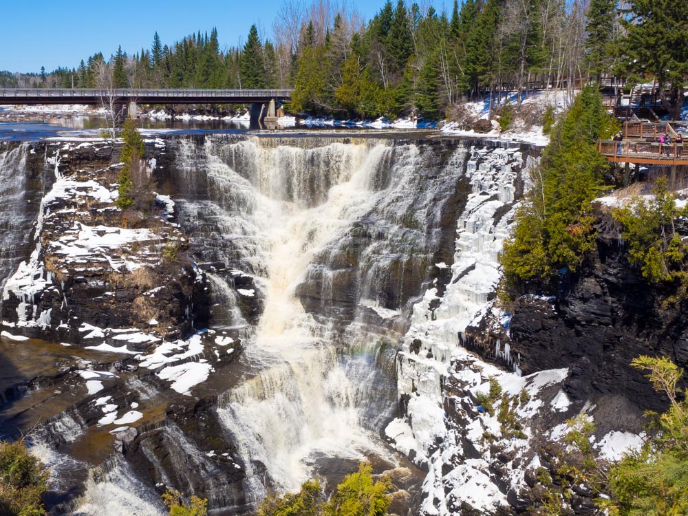 Every serious waterfaller eventually has to make the 'Thunder Run'.
In early summer, 2017, I also pushed further north into Northeast Ontario, finally reaching the big falls near Timmins. Together, these two trips provided a sizeable number of new waterfalls for the 3rd edition of the book. This time, the new photos were mine. While I was still no pro, my amateur photography skills had progressed sufficiently. The third edition of our book was published in 2018. It was bigger (pages and dimensions than before).

As I did with the second edition, I worked hard to upload an all-new web site. I had design help from Jeff Dingwell, and much help with the HTML and CSS from Dan Good. The web site was more complex than before, and pushing the limits of my meagre development skills.
9. The Covid Pandemic
In March of 2020, Ontario went into lockdown. The Covid-19 pandemic had started, and there was concern that the virus could spread rapidly and overwhelm our health care system. Millions of Ontarians were suddenly stuck at home, with nothing to do.
So they went outside.
During the lockdowns of 2020 and 2021, our province's outdoors took a real beating. Even in the conservation and natural areas near my home, there were suddenly 10 times as many people traveling on the trails. Who could blame them? The outdoors were safe, free and open!
People visited waterfalls like never before. Unfortunately, it was clear that many visitors had no experience being in the outdoors, and/or didn't share the same values that you and I do. Traffic jams, illegal parking, trespassing, littering all occurred at many waterfalls.
At Burleigh Falls , there were cases of visitors defacating on neighbour's front lawns. (no public washrooms were available... one reason why we were told not to travel). At Decew Falls there were so many illegally parked cars, that EMS had to tow cars before they could bring in fire trucks to resuce people that had been injured at the bottom of the gorge.
For the first time that I can remember, waterfalls started to close. Burleigh Falls and Decew Falls, but others as well. The crowds were too much, and nervous authorities feared that someone would get injured and/or the natural environment would suffer irreparable harm. This was the lowest point in my waterfalling hobby.
It was decided that the Facebook Group would no longer accept posts or photos made during the "Stay at Home Order". People were supposed to stay home to stop the spread. With close to half of the population living in the GTA, and only a handful of waterfalls in that area, this meant that people had to travel to get to waterfalls. As a public servant during my day job, I knew that this was against the intent of the Order.
The decision was very controversial, and our group lost members because of it. Other members doubled down and recognized that we didn't want our group to be part of the problem. Nobody wanted to be told to stay home. But, sheesh, there was nowhere to poop! Crowds were congregating at specific sites, and we still didn't know how safe it was to be outside in close proximity to one another. Was our group contributing to this?
During this crazy period, there was also some good news. The Toronto Star ran several excerpts from our book during fall, 2020. You can find a link to one here.
'Backroads Bill' Steer wrote an article that was featured in several northern newspapers. It was entitled Did you know waterfalls can make you happier. It included some interview statements from me and mentioned the book, website and Facebook group. Bill is the founder of the Canadian Ecology Centre and teaches at Nipissing University and Canadore College in North Bay.
 One of three short articles that appeared in the travel section.
Also, Peter Sacco worked with the legendary Canadian band, the Spoons, to put together a video to bring hope and inspiration. It featured cameos by Corey Hart, Jane Siberry, Ed the Sock, Alan Frew, Live Earl Jive, Bif Naked, David Marsden... and Mark Harris, "Ontario Waterfalls Author." I appeared for 2 seconds, but that was good enough for me!
 The Spoons were reportedly impressed to see that I had the original vinyl on hand for my clip.
Another by-product of the pandemic was that membership in our Facebook group 'Waterfalls of Ontario' started to explode. We went from over 4000 members in late 2019 to about 20,000 in mid-2020. The group moderators (Ann Behnke, Darlene Munro, David Reid, Gary Smith, LA Mabo, Russ Higgins and Terry Lupton) were doing a fantastic job to screen out idiots that wanted to sell us duct cleaning services or fancy sunglasses. Bad actors would "get the axe", and if they were really bad, they would "get the bat'lith."
As one illustration of how the pandemic impacted waterfalling, look at this graph below. It shows the rate of new Covid infections plotted with the rate of new members in our group. Either Covid caused our group to grow... or our group caused Covid to spread!

Things in the group got so busy that we added additional moderators, Anneke van Dyk, Sean Christopher and Shawn Brule. In addition to helping with our workload, they brought new ideas. (I'm getting too old for this, you know!)
By spring of 2021, Ontario was in another Stay-at-home Order, and the Facebook group again started to explode in size. At one point, we were getting 500 requests for people to join each day. We were only accepting about 60% of applicants, as many were applying from southeast Asia and clearly had no connection to Ontario's natural places. Facebook was actively promoting our group.
Given the recent problems with waterfall closures, public behaviour and the stress of having to constantly vet hundreds of new Facebook members each day, I looked for an escape valve. I was worried that our Facebook group would be labelled as "the group that ruined the waterfalls". I was also worried about mental health of our dedicated moderators (and me). We we scrolling on our phone multiple times per day to accept or reject multiple applicants. Our projections showed that we might reach 100,000 members by end of the year. Growth was growing exponentially.
Thus, with the notable oppostion of some group moderators, the 'Waterfalls of Ontario' facebook group turned 'private' around Canada Day, 2021.
By going private, we now had the ability to temporarily "hide" the group from prospective members. This would give us the abilty to put on the brakes if growth kept spiraling out of control. Unfortunately, this had the effect of killing growth outright. We suspected that Facebook was only promoting public groups, though we've been told that this isn't necessarily the case.
To add insult to injury, the switch to private appeared to have adjusted the notification settings of many members. I was contacted numerous times and told "Where are all the waterfall posts?" There were lots of posts, but Facebook appeared to have stopped many people from seeing them. (be sure to check notifications and choose "all", or "highlights").
Fortunately, even though the group isn't growing as quickly as it was (phew!), it is still thriving, really! At the time of writing, members continued to add 20, 30, or even 50 posts per day. Compared to many other groups, the quality of our feed continues to be very informed and almost 100% free of junk. I am proud of the work that the moderators and members do to keep this an awesome resource for sharing waterfall information and photos.
2021 and Beyond...
In the winter of 2021, I started to sell waterfall wall maps. These 36by24 inch maps are great gifts for the serious waterfaller. They won't help you to find the falls, but they help to show the big picture. I've heard from a few customers that have pinned them to a spare room wall and now mark where they have been with stickers or stars. Click to see wall map products that are available for purchase.
Through the summer of 2021, with the help of many Facebook members and site visitors, the 7th generation of the Waterfalls of Ontario web site was uploaded. This should be the cleanest, most useful generation yet!
Special thanks goes to Dan Good for helping to develop the updated waterfall map. It is more useful than ever. Dan believes in the grass roots promotion of local ecotourism and went above and beyound to help the project. I made the decision to feature only those waterfalls for which I could provide a photo or information. There are many more waterfalls that can be added once I obtain photos myself or from someone else. Can you help?
Most importantly, this page update would not have been possible without the input of hundreds of members of the broader Ontario waterfalling community. You will find many, many photos submitted by site visitors. Many of the descriptions have been informed by their input.
On October 3, 2021, the web site reached 1.5 million total hits since 2012!. This milestone is thanks to people like you!

Later in October, 2021, the Facebook Group started the #fallwaterfallchallenge. The idea was to see if members could collectively visit and post 100 different waterfalls in one month. Pfft! We reached 100 different falls in just ten days! A few months later, in early 2022 the #winterwaterfallchallenge proved that waterfallers weren't hiding indoors during winter! We also polled the group for the top 5 waterfalls in each of the 8 waterfall regions featured on this page and in the book. You can see the results of their votes on the web site.
In winter 2022, the first 'Waterfalls of Ontario' sticker went on sale. At $5.99, including delivery, this is a great way to show off that you are part of our community.

By early summer, 2022, the first 'Waterfalls of Ontario' badge went on sale. The idea, design and logistics behind the badge came from two members, David Carter and Jen Jarvis. At $8.99, including delivery, this is another great way to show off that you are part of our community. We heard from members that have sewn the badge on to backpacks or camera bags. Other copies were obtained by badge collectors who weren't even members of our group.
2022 continued to be a good year for 'Waterfalls of Ontario'. The fourth edition of the 'Waterfalls of Ontario' book was released. At 288 pages, it was longer than ever. George Fischer was back on the scene, contributing his gorgeous photos for about 15 new waterfalls. Most of the new sites were in the Parry Sound to Sudbury to Sault Ste Marie region.
The new book featured all new maps (this time, no waterfalls were indicated by an arrow pointing off the map!) and about 200 updates and corrections, many of which had been pointed out by readers. The introductory section was completely re-written and made about 33% longer. The same was true for the inventory of waterfalls at the back of the book. I was very pleased to see that Firefly Books was able to keep the price point at $29.95. Inflation was rampant during 2022, and yet here we had a (bigger) book that was selling for the same price as it did in 2004.

Who knows what we will find in the next chapter of waterfalling in Ontario. Will you play a role?
A Waterfallsofontario.com web page has been viewed this many times since May 29, 2012.
View Detailed Traffic Statistics
This page uploaded September 30, 2021.